
Walk a Vestavia Hills Street
A street directory search works best as a chain, not a one-box query. First decide whether the address lies in Jefferson or Shelby County. Most of Vestavia Hills is in Jefferson, while Liberty Park and other southeastern areas reach into Shelby. The postal city is not enough to decide. A Liberty Park address may use Birmingham in the mail and still sit within Vestavia Hills. Use the county GIS parcel layer to fix the jurisdiction before opening a tax or deed portal.
Ownership and occupancy are different facts. The tax roll and recorder establish parties tied to land. Voter and directory records can add resident evidence, but neither supplies a complete household. Keep the street number, parcel number, subdivision, lot, block, and each source date as the trail grows.
- Verify the address and county in the Jefferson or Shelby GIS map, then save the parcel number and legal description.
- Search the correct county property roll by property address. Compare the situs address with the owner's mailing address.
- Open the current acquisition deed, then record its grantor, grantee, date, instrument number, and lot or block citation.
- Use a lawfully requested voter-file extract as a separate street clue. The public self-lookup does not browse a whole block.
- For an older household, check the Birmingham directory street section and nearby public census years at the library.
Vestavia Hills Street County Split
The key street-directory choice comes before the name search. Jefferson County property questions go to its Tax Assessor or Board of Equalization, maps to Enterprise GIS, and deeds to Probate Recording. Shelby County uses its Property Tax Commissioner and GIS for parcels. Its recording page explains recorded instruments, while Shelby View services launch probate and parcel searches. Vestavia Hills City Hall keeps city permits, zoning, annexation, council files, and municipal cases on both sides of the county line.
Older labels require care. Rocky Ridge and Altadena parcels may appear under pre-annexation descriptions before the 1980s. Liberty Park joined Vestavia Hills in 1992, and Cahaba Heights followed in 2002. No verified citywide renumbering chronology was found. Preserve the subdivision and legal description rather than assuming a failed search means the record vanished.
Note: A Vestavia Hills or Birmingham mailing label does not establish the parcel county, city boundary, or correct records custodian.
Vestavia Hills Street Address Fields
The free Jefferson County property search offers two address fields that answer different questions. Property Address is the situs, meaning the physical location of the taxed parcel. Mailing Address is where tax correspondence goes. Matching values may support an owner-occupancy inference. Different values may suggest an owner receives mail elsewhere. Neither result proves who lives at the address or lists all residents.
| CAP search label | Input | Required | Street-directory use |
|---|---|---|---|
| Name | Text | No | Find a parcel under an indexed owner name |
| Parcel # | Text | No | Open one known tax parcel without relying on street spelling |
| Mailing Address | Text | No | Search the owner's correspondence destination |
| Property Address | Text | No | Search the physical or situs address |
| Tax Year | Dropdown | No | Choose the displayed assessment year |
The Board of Equalization also permits public-computer and individual-folder inspection. Its terminals are view-only and may be limited to ten minutes when others wait. The office allows up to 25 property folders per day, subject to availability, and does not provide parcel information by phone. Maps come from the assessor, while deeds come from Probate, so a missing item belongs with the office that created it. The official Jefferson County contacts route helps identify the correct desk before an in-person visit.
Shelby Street Segments by Map
The Shelby County GIS is stronger for selecting a visible run of parcels. Its basic suggestions identify an address, owner, or parcel. Advanced tools select by value or shape, limit a choice to the current map extent, and add or remove records from a set. A circle, polygon, line, or buffer can isolate the parcels fronting part of a street. Results can then be exported as CSV.
That export is an owner-and-parcel list, not a roster of residents. County GIS data may include road frontage, subdivision, lot, block, map book and page, acreage, instrument number, parent parcel, and tax year. Not every field is promised in the consumer popup. Use the map to reach the parcel, then confirm the owner and deed citation in the live tax and probate systems.
- Parcel
- A mapped unit of land with a county tax identifier.
- Situs address
- The physical address assigned to the property, distinct from an owner's mailing address.
- Plat
- A recorded map that identifies subdivision lots, blocks, streets, and easements.
- Criss-cross directory
- A directory arranged by street and number rather than only by a person's surname.
Vestavia Hills Street Record Layers
No single public roll answers who lives along a Vestavia Hills street. Each record has its own keeper, date, and blind spot. The street directory becomes more reliable when the parcel number links the tax roll to the deed, while an exact address links the parcel to city files and historic sources.
| Address-keyed source | Official keeper | Useful street evidence | Access route |
|---|---|---|---|
| Property roll | Jefferson BOE or Shelby Property Tax Commissioner | Indexed owner, situs, mailing address, parcel | Free web search; county office inspection |
| Parcel GIS | Jefferson or Shelby GIS | Lot geometry, nearby parcels, subdivision context | Free browser map |
| Recorded instruments | County probate recording office | Named parties, role, date, citation, legal description | Online index; paid images or records room |
| City permit and planning files | Vestavia Hills clerk and Building Safety | Address, applicant, project, date, ordinance context | Public notices or a narrow records request |
| Voter file | Alabama Secretary of State and county registrars | Released registration and residence-address fields | Paid official request; protected fields withheld |
| Historical street section | Birmingham Public Library | Published occupant clues by street and number | In-library directory research |
A current parcel result should be dated. A deed index entry establishes a recorded party and role, not present occupancy. Likewise, a directory entry captures what a publisher printed for one edition. The separate dates prevent a street-by-street list from blending past and present into one false snapshot.
Deeds Along Vestavia Hills Streets
After the parcel search, use the recorder to confirm how the indexed owner acquired the land. Jefferson County's LandmarkWeb recorded-record search offers Name, Document, Book and Page, Consideration, Record Date Range, Instrument Number, and Legal modes. A legal search can reconnect a parcel even when the display address changed. The public search can show data and a watermarked first page or index. Clean pages require purchase or subscriber access, while the Birmingham probate office also supplies copies.
The linked LandmarkWeb source below is the official entry point for a Vestavia Hills deed and instrument search. It bridges a street address to the parties and legal description in a recorded filing.
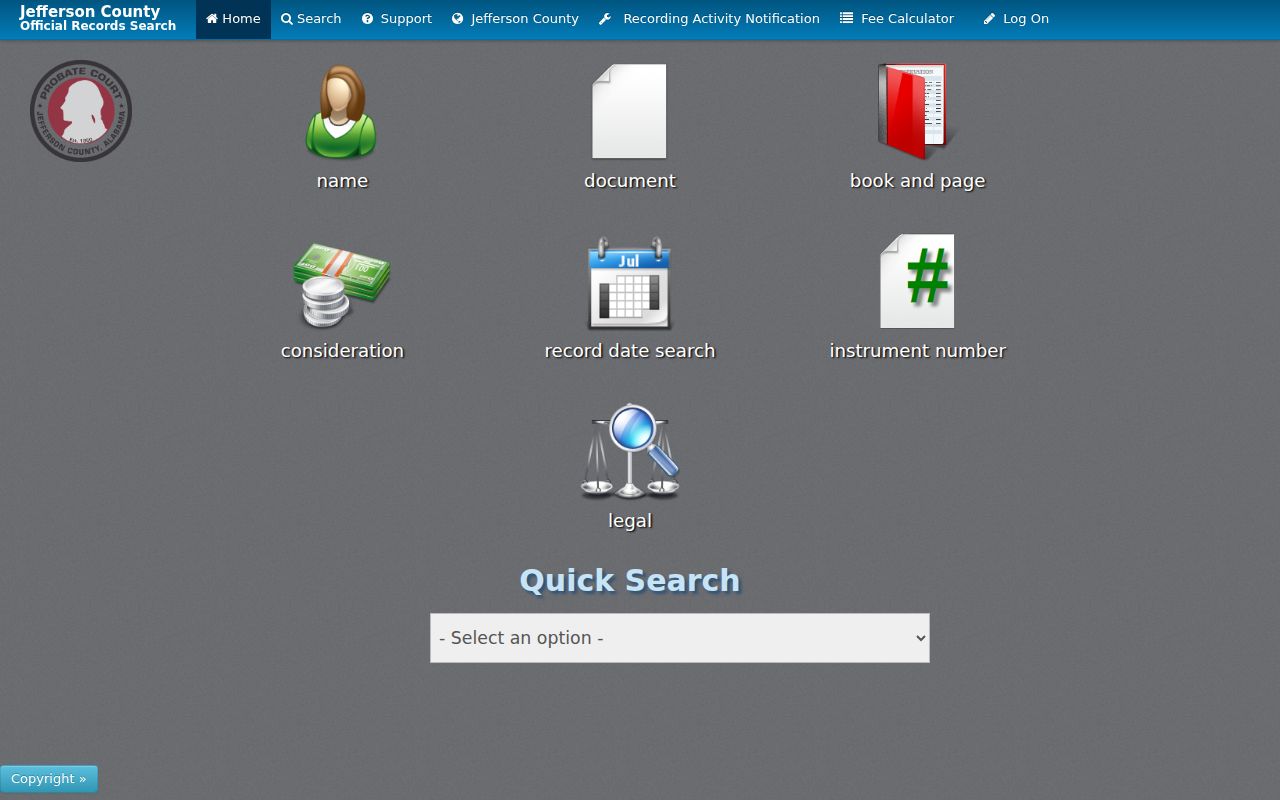
Use the resulting instrument number, book and page, or legal description to keep the same parcel in view as names change. An online cutoff was not stated by Jefferson Probate. When a search stops, bring the known parties, approximate date, property address, and recording citation to the office or send those details with a mailed deed request.
Vestavia Hills Voters by Street
The Alabama voter-list request is the official channel for address-sortable registration data. A requester may specify a city, county, or district and ask for released residence and mailing addresses, status, registration date, and election-participation fields. Electronic data costs one cent per voter under Ala. Code § 17-4-38. The self-service My Voting Information screen is for an individual lookup and should not be described as a browseable street roll.
A voter list remains partial. Alabama has no party-registration field, and participation history never discloses a ballot choice. People who are not registered will not appear. Inactive entries may also lag a move, while protected residents and certain officials may have information withheld. Sort a lawfully obtained file by address only as a dated registration snapshot, then compare it with the correct parcel record.
Note: Voter registration can support an address link, but it cannot prove a full household or current presence at that address.
Vestavia Hills Street Permit Clues
County records do not replace city files. Vestavia Hills keeps permits, inspections, zoning, annexation, council, and municipal material even for city parcels that fall in Shelby County. No public permit or code-case result index with a verified coverage date was found. The sound route is a narrow request by exact address, permit type, and date range through the city rather than a claim that the absence of an online hit means no file exists.
Vestavia Hills public notices can identify an owner or applicant, an address, lot, and ordinance in a rezoning or annexation matter. Those roles describe participation in a city proceeding. They do not establish residence. For an annexed tract, the packet can also bridge the date when the parcel moved into city records while its county deed and tax custodian stayed the same.
Older Vestavia Hills Street Directory
Past occupant research moves from modern parcel systems to the Birmingham-area directory shelf. Birmingham Public Library Southern History holds city directories from 1883 to the present, with no volumes published in 1933, 1936, 1943, or 1945. Search the person section, then the street or reverse section where the chosen volume provides one. A gap year is a publication gap, not evidence that a household moved.
Address labels can shift with annexation. Search Cahaba Heights under its older name before 2002, and test earlier jurisdiction labels for Rocky Ridge, Altadena, and Liberty Park. Preserve the lot and block whenever possible. For the full collection record and rules for reading entries, use the Vestavia Hills city directory collections before drawing conclusions from a missing name.
Vestavia Hills Street Directory Limits
A street directory can show recorded owners, mapped parcels, released voter registrations, permit applicants, and names printed in historical volumes. It cannot supply a complete current household. A parcel map omits people who do not own land. The voter roll omits nonvoters and protected fields. A mailing address may point away from the property. Minors, private membership lists, utility accounts, and motor-vehicle addresses do not become open resident rolls merely because an address is known.
Absence also needs restraint. A name may be missing because of a spelling variant, a portal cutoff, an unindexed image, a directory's publication boundary, or a lawful confidentiality rule. Check the records room, clerk, library, or archive channel documented for that source. State what the record does show and keep inference separate.
Lawful use. Use Vestavia Hills address records for lawful personal research, family history, or property study. Never use them to stalk, threaten, intimidate, or harass anyone.